Site overview

The Mine de Villaret at Susville, in the Isère department, was the last and most technically advanced shaft of the Matheysine anthracite coalfield and the final working mine of the Houillères du Bassin du Dauphiné. Coal extraction in the area is recorded from the seventeenth century, and organised industrial exploitation developed through the early nineteenth century under successive concession holders. Following nationalisation in 1946, which created the Houillères de bassin du Dauphiné from the assets of the Compagnie des Mines d'Anthracite de La Mure and associated concessions, the production centre progressively shifted to the Villaret site at Susville.

Sinking of the Villaret shaft began in 1948 using ground-freezing techniques to cross aquifers, and the shaft was operational by 1953. It reached 270 metres in diameter 6.5 metres and was deepened to approximately 560 metres as extraction progressed. Production peaked at a record 791,000 tonnes in 1966.

Political decisions to close French coalfields led to a government announcement in 1968 of closure by 1975; the oil crises of the 1970s postponed this, but the Pacte Charbonnier of October 1994 set a terminal date. The puits du Villaret closed on 28 March 1997, the last mine in France to close under the Pacte. The shaft was subsequently backfilled and sealed.

The headframe was repainted and received the Patrimoine en Isère label in 2008. Following partial site dismantlement in 2015, the headframe, the former coal magazine, and some adjacent buildings survive. A commemorative fresco was added to the headframe building in 2015.

The site stands in a broad mountain valley landscape at Susville, where the surviving headframe and buildings read as a distinct former pit site against open ground and rising slopes.

Map & photo

Mine de Villaret — Puits du Villaret mine headframe or winding tower site
Photograph taken: 11 May 2026
Map markers and directions links are provided for location reference only and do not indicate public access or permission to enter a site.

History

The Matheysine plateau in Isère lies at approximately 900 metres altitude and contains a synclinal anthracite gisement within the Belledonne crystalline zone. Although the presence of coal was known in the medieval period — a text of 1455 refers explicitly to mining near La Mure — exploitation for industrial purposes developed from the seventeenth century, initially to supply lime kilns in the Grenoble region. In 1768 the baron de Venterol, seigneur de La Motte, opened the first horizontal galleries at La Motte-d'Aveillans.

The concession framework was established under Napoleon: six concessions were granted from 1805 onwards, the most important being those of the Peychagnard, La Grand'Draye, and the Béthoux. Three of these united in 1806, and the field was progressively consolidated. In 1856, Jules Giroud and his associates established a single company to manage the principal concessions: the Compagnie des Mines d'Anthracite de La Mure. Production reached 75,000 tonnes in 1860, crossed 100,000 tonnes in 1879, 200,000 tonnes in 1901, and 400,000 tonnes in 1930. The opening of the railway from La Mure to Saint-Georges-de-Commiers in 1888 — electrified in 1903 as the first electrified railway line in the world — greatly boosted the ability to market anthracite nationally and internationally.

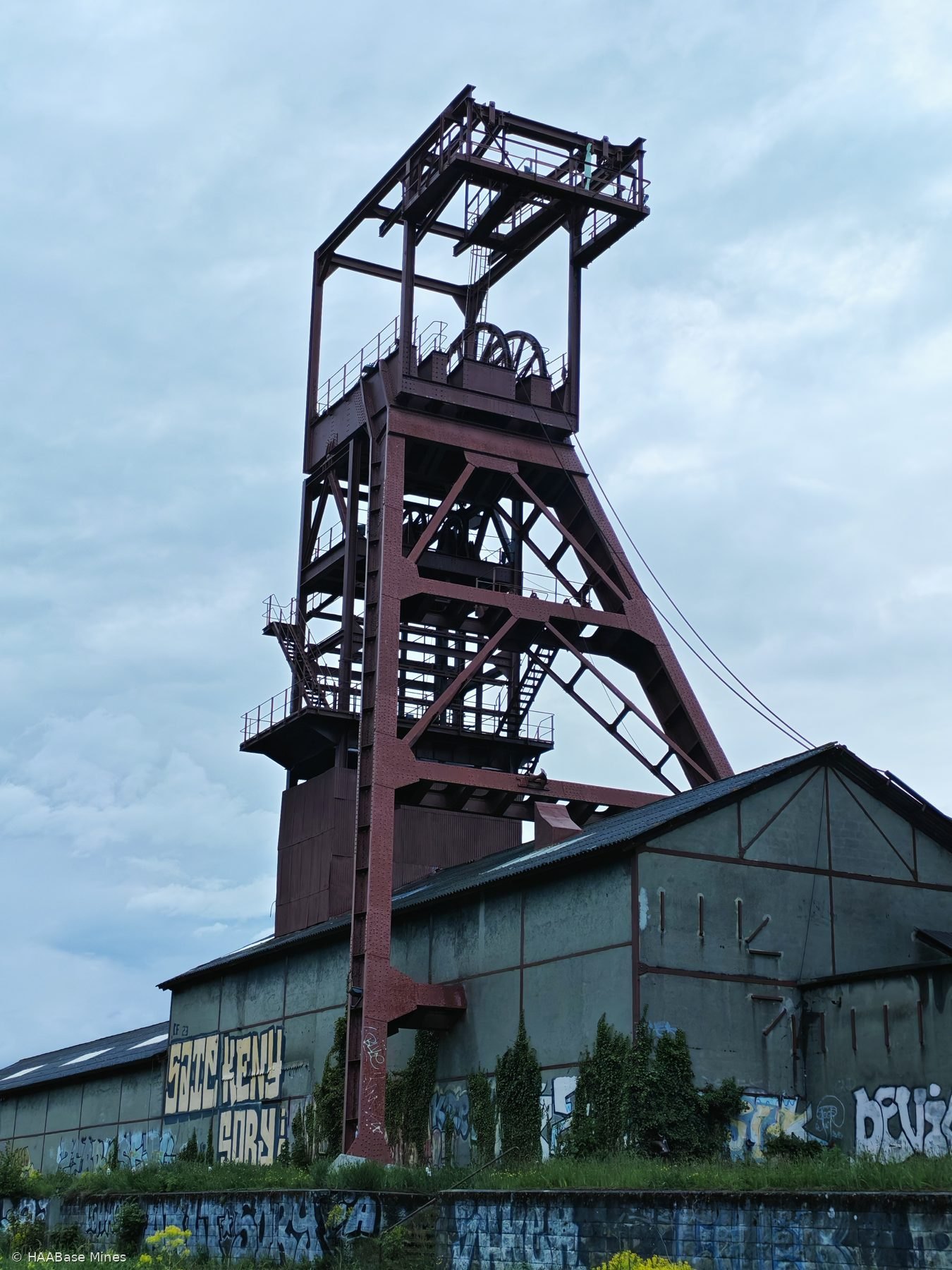
Three major shafts were sunk across the Matheysine field: the puits Sainte-Marie at La Motte-d'Aveillans (1905), the puits des Rioux at Prunières (1942), and the puits du Villaret at Susville (1948). The puits du Villaret was sunk by the Houillères du Bassin du Dauphiné following nationalisation by decree of 28 June 1946 (effective 1 July 1946), which had created the HBD from the Compagnie des Mines d'Anthracite de La Mure and associated concessions. The Houillères du Bassin du Dauphiné were integrated in 1968 into the wider Houillères de Bassin du Centre-Midi.

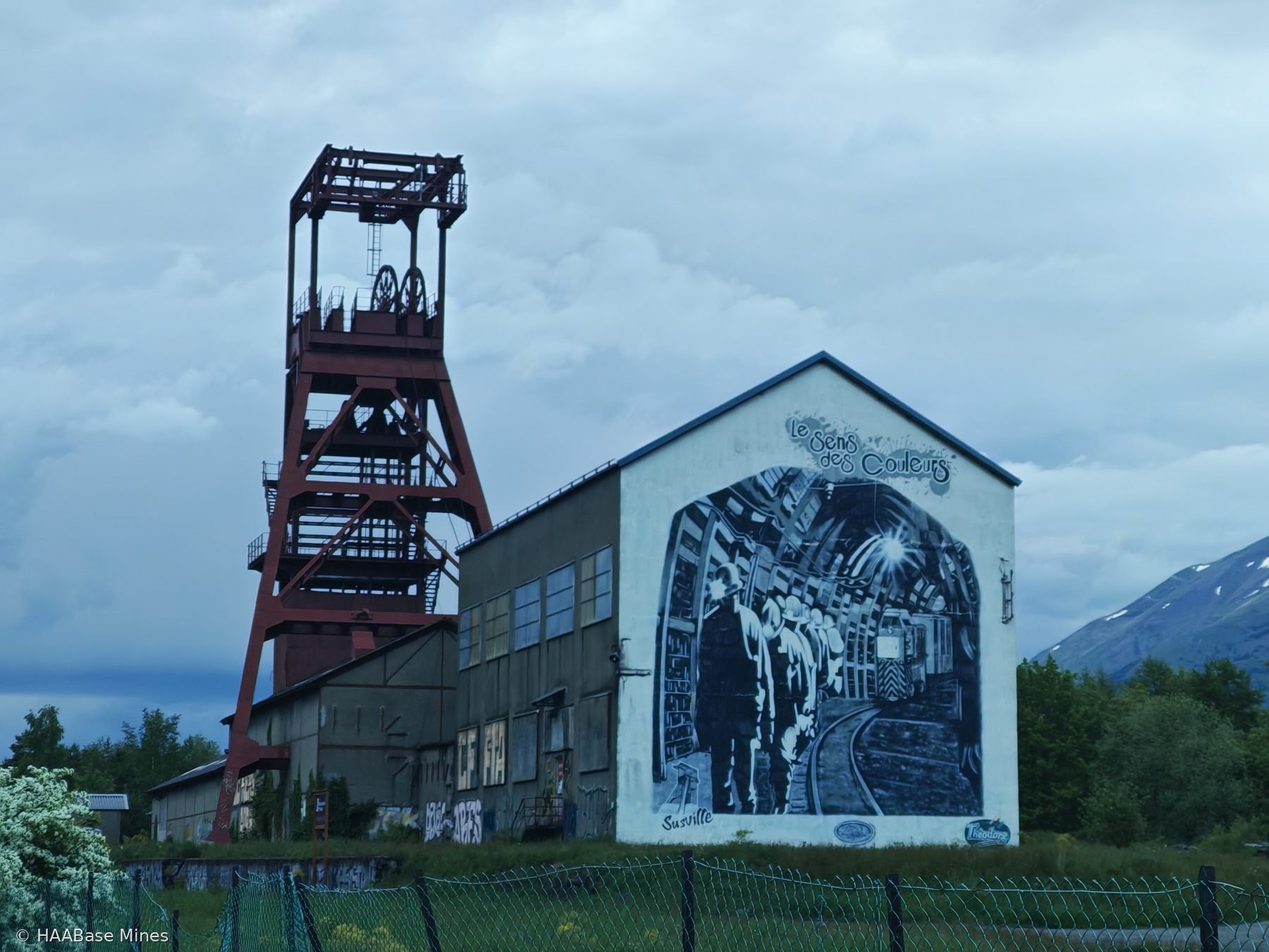
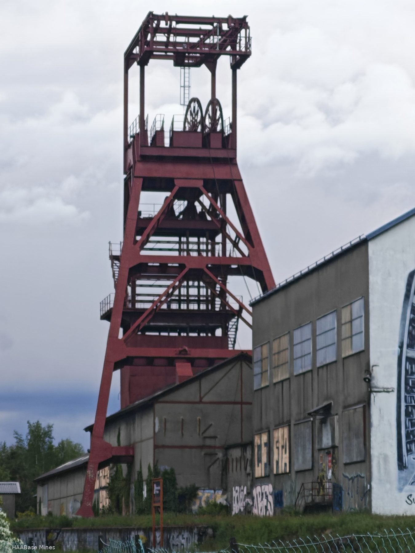
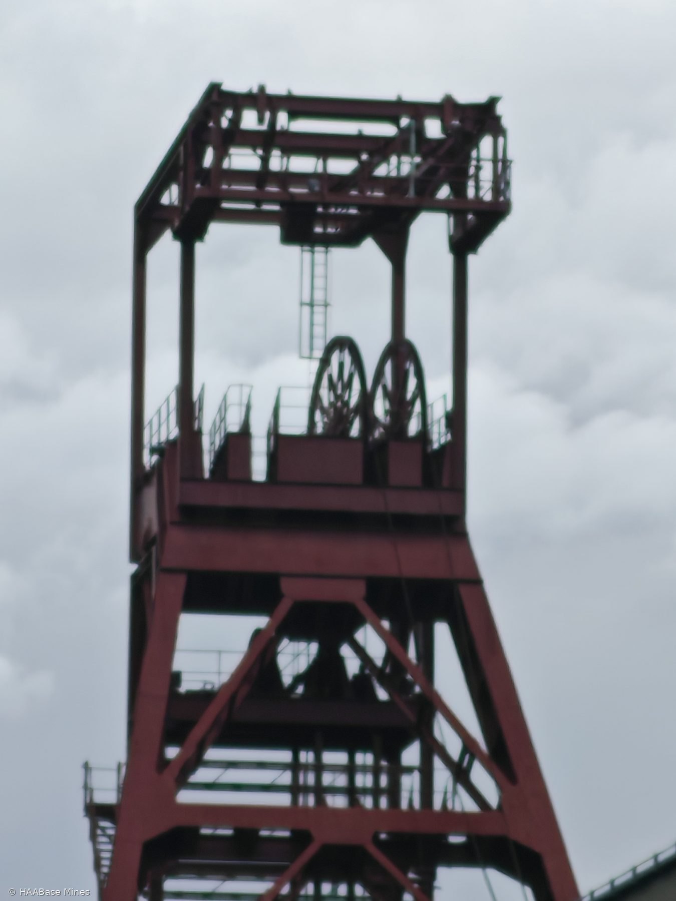
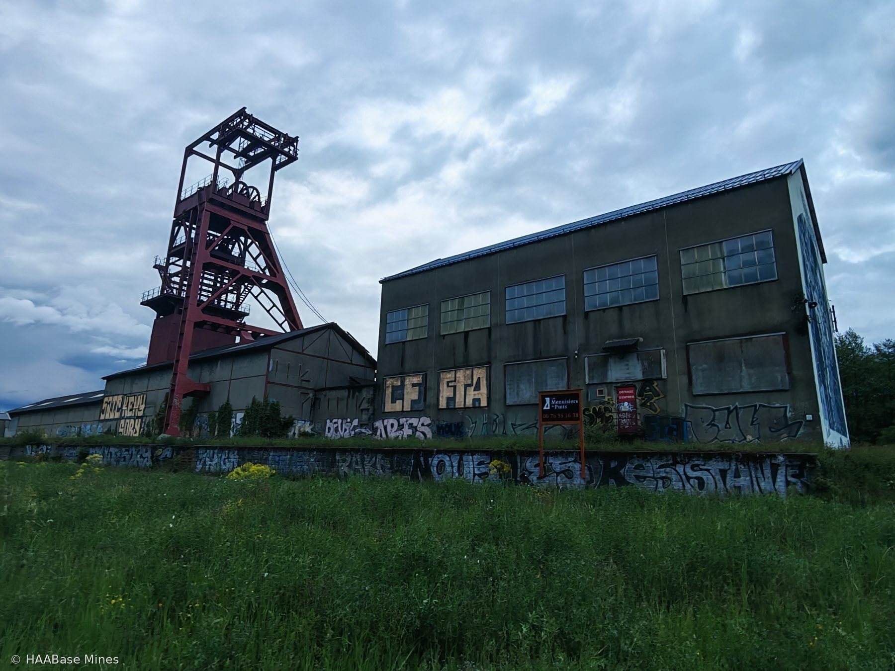
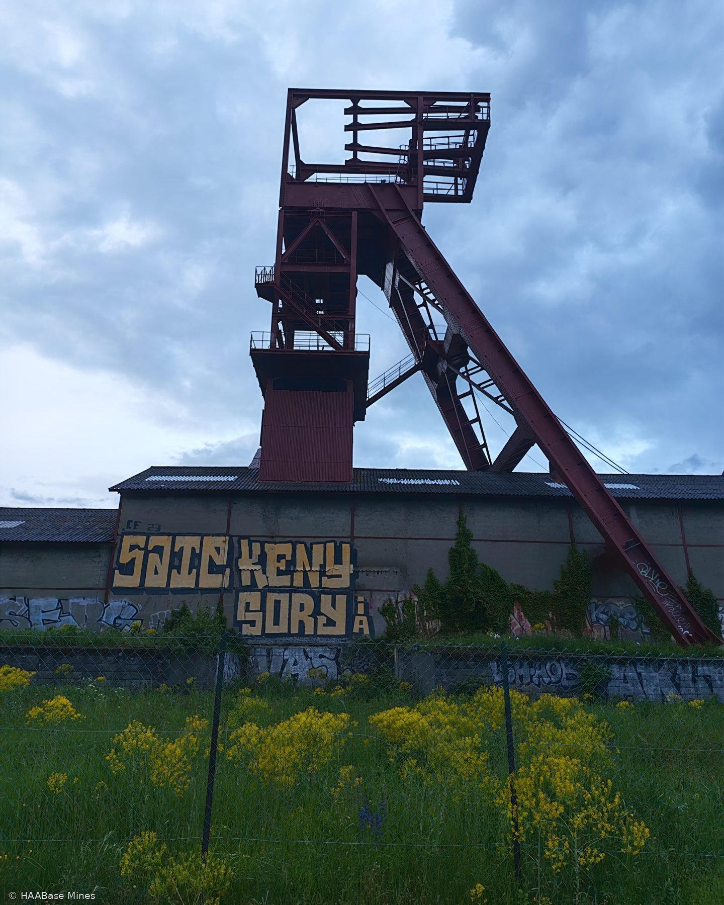
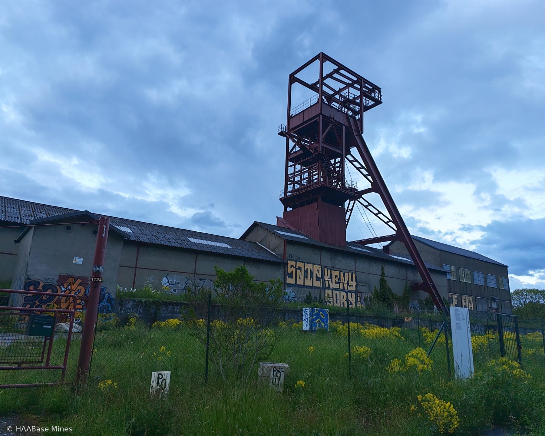
Sinking of the Villaret shaft began in 1948. The ground conditions encountered at the site — specifically the presence of aquifers — required the application of ground-freezing techniques to consolidate more than 100 metres of saturated strata during sinking. The shaft has a diameter of 6.5 metres and an initial depth of 270 metres. The headframe was complete by 1950 and the shaft was operational from 1953. The cage could carry thirty persons; in practice the shaft served primarily for the transport of personnel, materials, and the removal of waste rock (stériles) by 3,000-litre berlines. Coal extraction was brought to the surface via conveyor belt systems connected to the underground workings.

During the 1950s, the production centre of the field shifted from La Motte-d'Aveillans — whose site closed in 1956 — to the Villaret. From 1948 to 1970 the productivity (rendement fond) of the HBD tripled, rising from 1,000 to 3,147 tonnes per man per shift. The Villaret was the field's showcase for mechanisation: pick-working underground gave way to cutting machines (haveuses) and ploughs (rabots). Total basin production passed 385,000 tonnes in 1948 and reached a record of 791,000 tonnes in 1966.

In 1968, the French government announced for the first time that the Houillères du Dauphiné would close by 1975. The 1973 oil crisis and the Kippour War temporarily reversed this policy and sustained production at 300,000–400,000 tonnes with approximately 1,000 workers in 1980. In 1984 the government revised energy policy in favour of nuclear power and gas. In 1989 the minister of industry announced closure by 1994; opposition from miners, the local population, and elected representatives delayed implementation. The Pacte Charbonnier, signed on 20 October 1994 between the Charbonnages de France and the social partners (with the exception of the CGT), set the closure of all French coal production by 2005. The mines of La Mure were the first to close under this agreement. The puits du Villaret closed on Friday 28 March 1997, when the last tonne of anthracite from the Matheysine was brought to the surface.

Following closure the shaft was backfilled and sealed with a concrete slab. The headframe was repainted in red-brown and equipped with floodlighting in 2009; a silhouette of a miner was placed on the highest walkway. The site received the departmental label Patrimoine en Isère in 2008. In 2015, a commemorative fresco was painted on the south facade of the headframe building by the studio le Sens des Couleurs, depicting the mining history of the commune and the territory. Sources indicate the site underwent partial dismantlement in 2015; the headframe, the coal magazine (halle à charbon, partly dated to the nineteenth century), the salle des machines, the pithead building (recette jour), workers' housing (the cité minière), the former siège, and the former coopérative survive on or near the site. The surrounding land is largely cleared and given over to industrial and commercial zones, with the spoil heaps (rasiers) in the process of revegetation.

Timeline

1805–1806
Legislation

Initial concessions granted

Six concessions are granted for the Matheysine field from 1805, including the Peychagnard (1 November 1805), the Grand'Draye (4 July 1806), and the Béthoux (18 September 1806). Three concessions are grouped together in 1806.
1856
Legislation

Compagnie des Mines d'Anthracite de La Mure formed

The principal concessions are consolidated into a single management structure: the Compagnie des Mines d'Anthracite de La Mure is founded in 1856.
1888
Construction

Railway La Mure – Saint-Georges-de-Commiers opens

The railway linking La Mure to Saint-Georges-de-Commiers opens in 1888, substantially boosting the capacity to market anthracite nationally and internationally.
1946
Legislation

Nationalisation: Houillères du Bassin du Dauphiné created

The nationalisation decree of 28 June 1946 (effective 1 July 1946) creates the Houillères de bassin du Dauphiné from the Compagnie des Mines d'Anthracite de La Mure and associated concessions.
1948
Construction

Sinking of the puits du Villaret begins using ground-freezing technique

Sinking of the puits du Villaret begins in 1948. To traverse aquifers, the ground is frozen over more than 100 metres of depth during construction. The shaft diameter is 6.5 metres.
1950
Construction

Headframe completed

The headframe of the puits du Villaret is completed in 1950.
1953
Operation

Shaft becomes operational

The puits du Villaret enters operational service in 1953, serving primarily for personnel and materials transport and the removal of waste rock, with coal brought to surface via underground conveyor systems.
1956
Operation

Production centre shifts to the Villaret following closure of La Motte-d'Aveillans

Following the closure of the puits Sainte-Marie site at La Motte-d'Aveillans in 1956, the Villaret becomes the main production centre of the Matheysine field.
1966
Operation

Record production of 791,000 tonnes

Production at the Houillères du Bassin du Dauphiné reaches its all-time record of 791,000 tonnes in 1966.
1968
Closure

First government announcement of closure by 1975

In 1968, for the first time, the French government announces a planned closure of the Houillères du Dauphiné by 1975.
1968
Legislation

Houillères du Bassin du Dauphiné integrated into Houillères de Bassin du Centre-Midi

In 1968 the Houillères du Bassin du Dauphiné are merged into the wider Houillères de Bassin du Centre-Midi.
1994
Legislation

Pacte Charbonnier signed

The Pacte Charbonnier is signed on 20 October 1994 between the Charbonnages de France and the social partners (excluding the CGT), providing for the cessation of all French coal production by 2005. The mines of La Mure are designated as the first to close.
1997
Closure

Puits du Villaret closes — last mine in Matheysine

The puits du Villaret closes on Friday 28 March 1997, when the last tonne of anthracite from the Matheysine is brought to the surface. It is the last mine to close under the Pacte Charbonnier.
1997
Closure

Shaft backfilled and sealed

Following closure, the puits du Villaret shaft is backfilled and sealed with a concrete slab for safety.
2008
Heritage

Patrimoine en Isère label awarded

The puits du Villaret site receives the departmental Patrimoine en Isère label in 2008.
2009
Heritage

Headframe repainted and illuminated

In 2009 the headframe is repainted in red-brown and fitted with floodlighting. A silhouette of a miner is placed on the highest walkway as a commemorative feature.
2015
Heritage

Commemorative fresco added; partial site dismantlement

In 2015 a commemorative fresco depicting the mining history of the commune is painted on the south facade of the headframe building by the studio le Sens des Couleurs. The site undergoes partial dismantlement in the same period; the headframe, coal magazine, pithead building, and workers' housing survive.

Sources and records

Wikipedia article (French): Puits du Villaret
Wikipedia article (French): Houillères du Dauphiné
Inventaire général du patrimoine culturel Auvergne-Rhône-Alpes: notice IA38001007 (Mine d'anthracite de la Mure dit puits du Villaret et cité minière)
Mairie de Susville official website: le patrimoine minier
Patrimoine-minier.fr: Houillères du Dauphiné (Villaret section)
Patrimoine du Dauphiné: Le Puits du Villaret, l'histoire du géant des mines de la Mure
Éditions Arthéma: Histoire des Mines de La Mure, en Isère
Matheysine Tourisme: Site minier du Villaret
This researched site record is part of the HAABase Mines database. Normal personal research and browsing is welcome. Automated bulk extraction, republication, or harvesting of site text and images is not permitted without written consent.